Our Aerial Services
Experience cutting-edge aerial drone solutions tailored for your unique project needs.
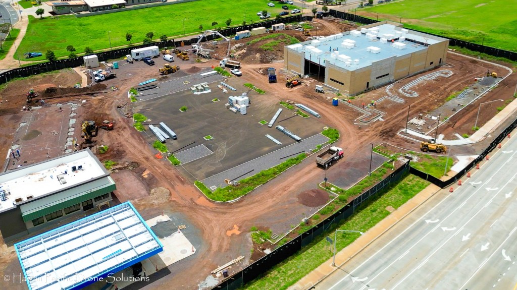
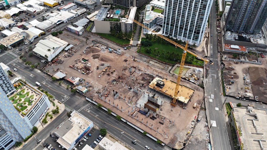
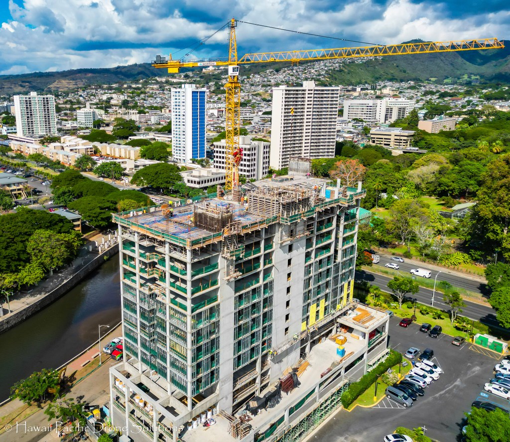
Leading-Edge Construction & Infrastructure Solutions
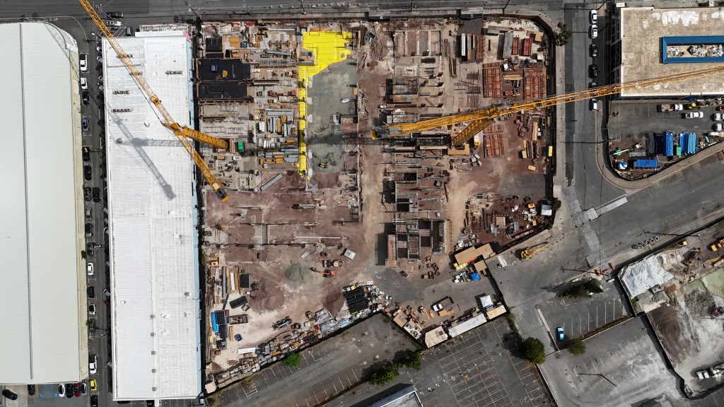
Our aerial imaging and inspection services cater to diverse industrial sectors, offering a safer, more efficient alternative to traditional methods. With our drones, we swiftly access challenging areas, providing high-resolution visuals and 3D models for maintenance, project planning, and monitoring.
Stay informed on your project’s progress through our meticulous aerial monitoring. Our drones capture high-resolution images at various stages, offering options for weekly, monthly, or annual updates to track and understand the evolution of your project seamlessly.
Innovative Advanced Aerial Mapping & Surveying
We specialize in advanced aerial mapping and surveying, harnessing cutting-edge drone technology to deliver unparalleled accuracy and detail. Our services revolutionize the way construction and infrastructure projects are planned, offering precise topographical data and high-resolution imagery.
Our state-of-the-art drones equipped with sophisticated sensors and cameras enable rapid, cost-effective surveys, significantly reducing project timelines and enhancing decision-making processes. By choosing us for your aerial mapping and surveying needs, you ensure superior quality deliverables that set new industry standards.
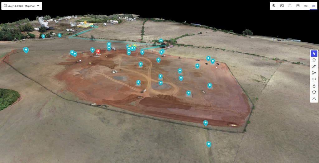


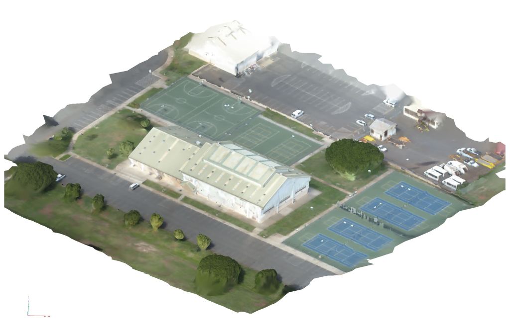
Inventive High-Resolution 3D Modeling of “Digital Twins”
We can create high-resolution 3D models and “digital twins”, essential for modern construction and infrastructure projects. Our advanced drone technology captures every detail, transforming physical spaces into accurate, interactive 3D models. These digital twins serve as a powerful tool for project managers and stakeholders, allowing for precise planning, monitoring, and decision-making. By choosing our services, you ensure unparalleled accuracy and efficiency in your projects, setting a new standard in the industry.


Impactful Industrial Inspection Services
In the complex world of construction and infrastructure, we can provide detailed insights and high-resolution imagery, surpassing traditional inspection methods. This innovation not only enhances safety but also delivers superior data quality, making us a pivotal partner for businesses seeking reliability and excellence. Our innovative approach also significantly reduces inspection times, allowing for faster project turnaround and increased productivity.


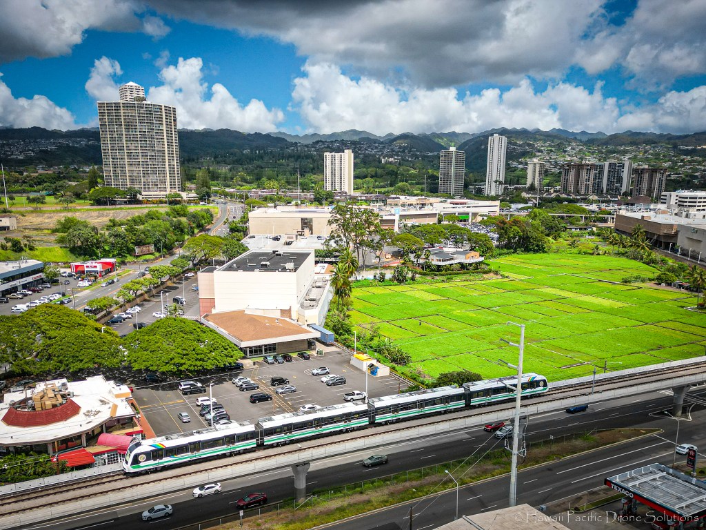
Impressive Commercial Real Estate Photography & Video
Let us help you enhance the visibility and allure of your property listings, setting them apart in a competitive market. Our pilots can capture stunning aerial views, showcasing properties in their entirety and revealing unique perspectives that traditional photography cannot match.
Leveraging our high-quality imagery and video, real estate professionals can effectively highlight key features of properties, from sprawling layouts to intricate architectural details. This visual storytelling not only captivates potential buyers but also significantly aids in faster, more efficient sales, elevating your property above the competition.
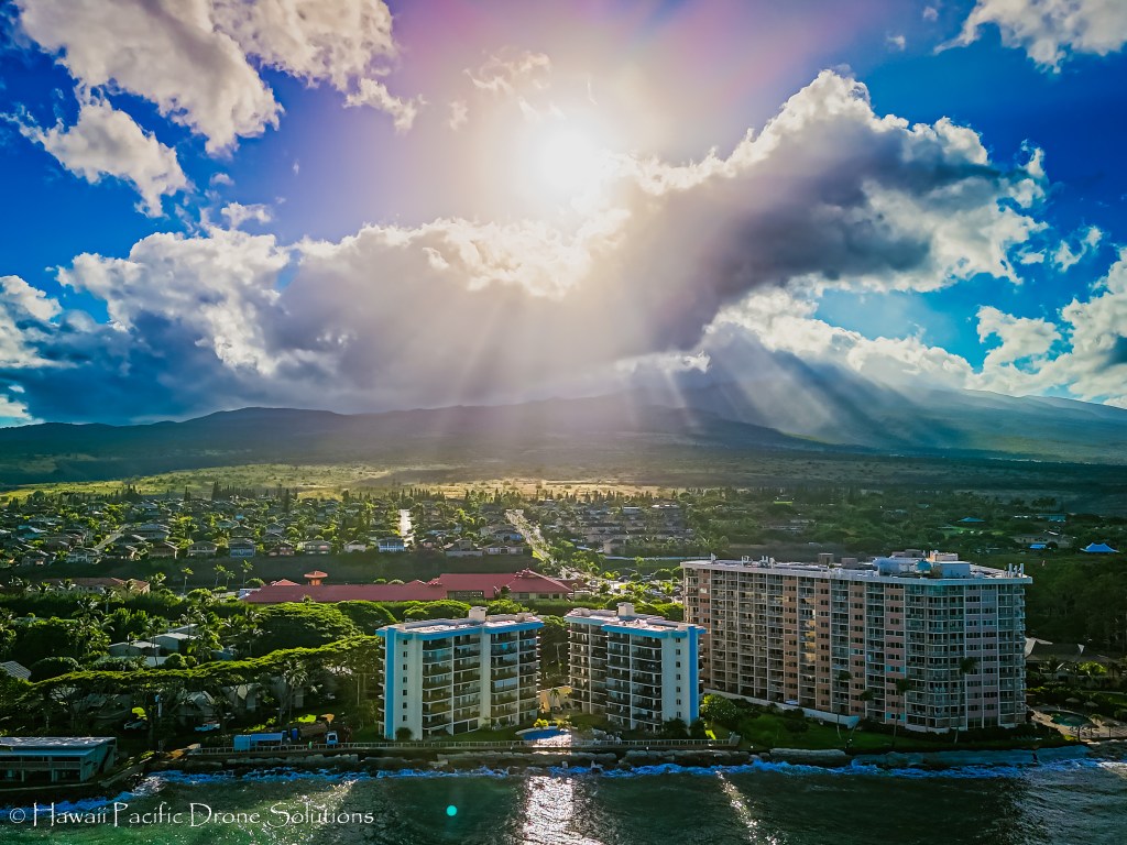

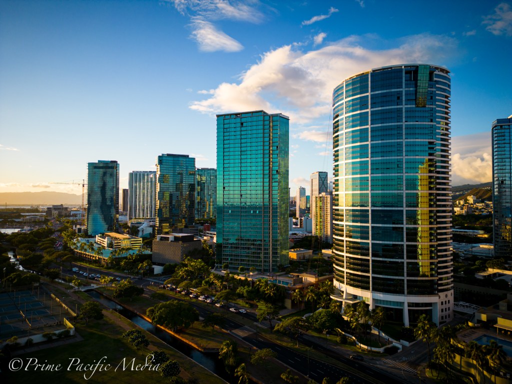
Inspiring Marketing Imagery & Media
We excel at capturing breathtaking aerial imagery and media that elevate your marketing to new heights. Leverage our expertise in aerial photography to create compelling visual narratives that captivate your audience and set your brand apart. With Hawaii Pacific Drone Solutions, you gain a powerful tool in your marketing arsenal, delivering impactful imagery that resonates with your clients and enhances your brand’s visibility.


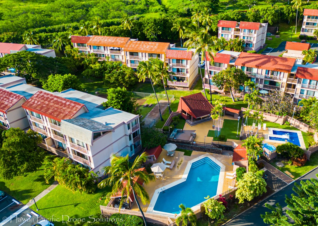
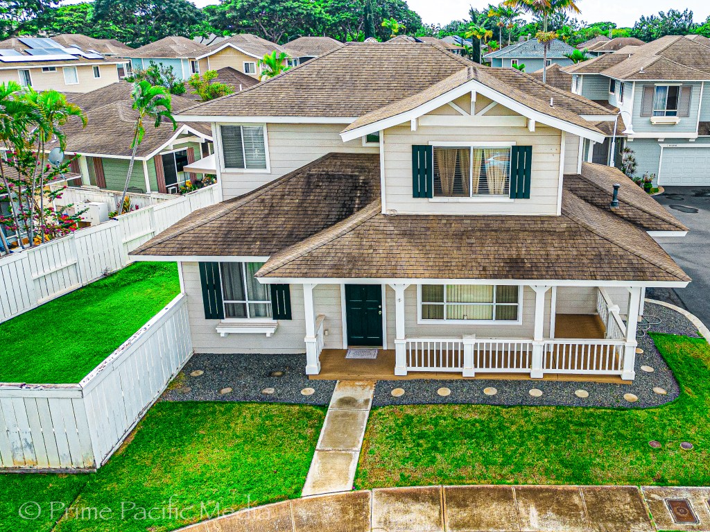
Stunning Residential Real Estate Photography & Video
In the competitive real estate market, captivating visuals are essential. Hawaii Pacific Drone Solutions provides exceptional aerial photography and videography, transforming ordinary property listings into stunning showcases. Our advanced drone technology captures high-resolution images and smooth videos that highlight every unique feature of a property. With our expertise, your listings will stand out, attracting more potential buyers and driving sales.
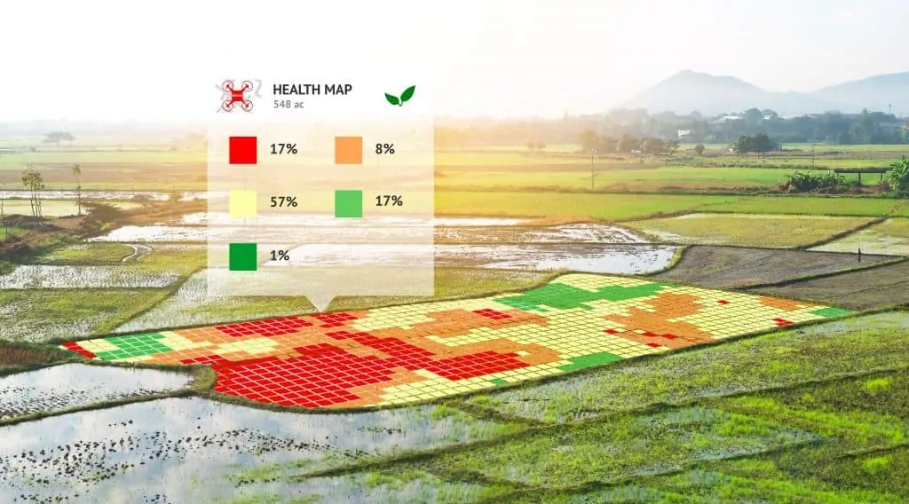
Cutting-Edge Precision Agriculture & Land Management
Precision agriculture and land management represent a revolution in optimizing crop yields and managing land resources effectively. Our drone technology at Hawaii Pacific Drone Solutions provides accurate, high-resolution aerial data, essential for monitoring crop health, soil conditions, and irrigation needs.
In the realm of land management, our drones offer unparalleled capabilities in surveying vast areas, enabling better planning and sustainable land use. By integrating advanced analytics, we help clients make informed decisions, ensuring efficiency and productivity in their agricultural and land management practices.