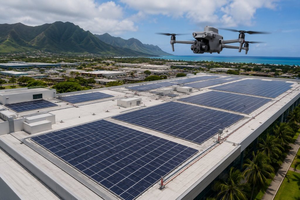
A thermal drone inspection can help a facility manager, solar operator, engineer, contractor, or government agency document temperature patterns across a large or difficult-to-access asset.
However, the value of the inspection does not come from simply flying a drone equipped with a thermal camera. Useful results depend on selecting the right conditions, understanding the client’s objective, capturing both thermal and visible images, and organizing the information so the appropriate professionals can review it.
This guide explains what commercial thermal drone inspections in Hawaii can provide, what affects the results, and where further professional evaluation may be needed.
What is a commercial thermal drone inspection?
A commercial thermal drone inspection uses an airborne infrared camera to document temperature differences across the surface of an asset.
Depending on the project, that asset might include:
- A large rooftop or ground-mounted solar array
- A commercial or institutional roof
- A warehouse, school, office, or public facility
- Industrial or energy equipment
- A building exterior or other hard-to-access area
Thermal imagery can make unusual temperature patterns easier to locate across large areas. It does not see through roofs, walls, solar panels, or equipment. It also cannot determine the cause of a temperature difference by itself.
The results are most useful when the thermal images are connected to clear visible photographs and reviewed in the context of the asset, weather, operating conditions, and project objective.
When is aerial thermal imaging useful?
Aerial thermal imaging is useful when the project team needs consistent coverage across an area that would be slow, difficult, or potentially hazardous to observe from the ground.
For solar projects, a drone can document temperature patterns across many panels while the system is operating. Specialized analysts can then review the collected data for apparent anomalies that may require closer investigation.
For commercial rooftops and facilities, thermal imagery may help identify areas with different surface-temperature behavior. These areas could be considered for additional evaluation by a roofing consultant, engineer, facility professional, electrician, or certified thermographer.
Thermal imaging can also support baseline documentation and future comparisons. Repeat inspections are more useful when the flight plan, environmental conditions, viewing angles, and data organization are reasonably consistent.
A useful project starts with the right question
Before the flight, the client and drone operator should agree on what the inspection is intended to support.
Important questions include:
- What asset or area needs to be documented?
- What concern or decision prompted the inspection?
- Who will review the results?
- Does the reviewer need standard thermal images, radiometric files, visible photographs, maps, annotations, or raw source data?
- Must the solar array or equipment be operating under certain conditions?
- Will a specialist perform deeper analysis after the flight?
- Are there access, security, airspace, traffic, tenant, or active-site restrictions?
The answers determine how the mission should be flown and how the information should be delivered.
A generic thermal flight may produce interesting images without providing the coverage, conditions, or file structure needed to answer the client’s actual question.
Why weather and site conditions matter
A thermal camera records infrared energy associated with the surface it is viewing. Many factors besides the condition of the asset can affect the apparent temperature.
These may include:
- Direct sunlight and recent heating
- Passing clouds
- Wind
- Rain or moisture on the surface
- Time of day
- Ambient temperature and humidity
- Reflections from the sky, nearby buildings, or equipment
- Camera angle and distance from the asset
- The type and finish of the material
- Whether equipment is operating or under load
Different materials also release and reflect infrared energy differently. This characteristic is known as emissivity. In practical terms, a dark roofing material, reflective metal surface, glass panel, and concrete surface may not produce directly comparable thermal readings.
These factors are why the correct inspection window depends on the asset and the purpose of the project. There is no single set of conditions that works for every commercial thermal inspection.
Technical guidance from FLIR explains how factors such as emissivity, reflected temperature, distance, humidity, and atmospheric conditions can affect temperature measurement.
For outdoor photovoltaic systems, IEC TS 62446-3 provides guidance covering equipment, environmental conditions, procedures, reporting, and personnel qualifications. A project should not be described as compliant with that standard unless the required procedures and qualifications are specifically included in the scope.
Why thermal and visible images should be captured together
A thermal image may clearly show a temperature difference while providing very little recognizable detail about its location.
A corresponding visible photograph helps the reviewer connect that pattern to a specific panel row, roof section, building area, or piece of equipment.
Paired or cross-referenced imagery can help project teams:
- Locate an apparent anomaly
- Understand the surrounding physical condition
- Communicate findings between multiple stakeholders
- Direct closer ground-based evaluation
- Organize maintenance or follow-up work
- Compare the same general area during a later inspection
The goal is not merely to collect a large number of thermal images. The goal is to create a usable record that another professional can understand and retrieve efficiently.
What should the client receive?
The appropriate deliverables depend on who will use the data and what they need to determine.
A commercial thermal inspection may include:
- Thermal images
- High-resolution visible photographs
- Radiometric thermal files
- Raw source imagery
- Folders organized by property, building, array, or area
- File names or references that help locate each documented area
- Maps or other visual location aids
- Notes identifying apparent thermal anomalies
- Data prepared for a qualified specialist or analysis provider
Radiometric files contain temperature information that compatible software can evaluate after the flight. They are particularly important when a specialist needs access to more than the colors displayed in an exported thermal image.
The required file type should be confirmed before capture. A standard image may not contain all the underlying information needed for deeper analysis.
What thermal imagery can and cannot determine
Thermal imagery can document apparent surface-temperature differences under the conditions present during the flight.
Those patterns may help a project team prioritize closer inspection, additional testing, maintenance review, or comparison with other parts of the asset.
Thermal imagery alone does not automatically confirm:
- A roof leak or the source of water intrusion
- Trapped moisture
- Failed insulation
- An electrical defect
- A defective solar panel
- Structural damage
- The cause of unusual heating
- The repair that should be performed
These conclusions may require ground testing, electrical measurements, moisture verification, building records, engineering review, or other professional evaluation.
A responsible thermal inspection clearly separates what was observed from what has been professionally diagnosed.
Why Hawaii projects require additional planning
Commercial thermal drone inspections in Hawaii must account for both the thermal conditions and the practical requirements of operating at the site.
Strong sunlight can create uneven heating and reflections. Passing clouds and brief rain events may change conditions during a flight. Wind can affect aircraft positioning and how quickly some surfaces gain or lose heat.
Sites in Honolulu and other developed areas may also involve controlled airspace, nearby buildings, limited launch areas, pedestrians, vehicles, security restrictions, and active facility operations.
Multi-island projects require additional planning for equipment transportation, site access, weather contingencies, scheduling, and coordination with local facility representatives.
Commercial flights are generally conducted under FAA Part 107. Flights in controlled airspace may also require an FAA airspace authorization.
These issues should be addressed during planning rather than after the crew arrives.
Experience matters, but so does knowing the limits
Hawaii Pacific Drone Solutions has conducted commercial thermal data collection for rooftop solar systems at national retail facilities, pre-installation and post-installation roof documentation, solar farms across the Hawaiian Islands, and solar inspections at multiple State of Hawaii DOE schools.
HPDS uses the DJI Matrice 4T to capture radiometric thermal files and corresponding visible imagery. When a project requires specialized solar analysis or another deeper technical interpretation, the collected data can be provided to the appropriately qualified analysis provider or project professional.
This division of responsibility keeps the aerial documentation useful without confusing an observed temperature pattern with a final diagnosis.
Choosing a commercial thermal drone provider
A commercial buyer should ask a prospective provider:
- Can the provider explain what the imagery can and cannot determine?
- Will the flight conditions be selected for the asset and intended use?
- Will thermal images be supported by visible photographs?
- Are the file formats appropriate for the person analyzing the data?
- Will the deliverables be organized by location or asset?
- Have airspace, access, weather, and active-site conditions been addressed?
- Is there a clear handoff when specialized analysis is required?
The drone and camera matter, but they are only part of the service. Planning, field execution, data organization, and clear professional boundaries determine whether the final information is useful.
Discuss a commercial thermal project in Hawaii
Organizations considering a commercial thermal drone inspection should begin by defining the asset, concern, required deliverables, and person responsible for interpreting the results.
Hawaii Pacific Drone Solutions supports thermal data collection for commercial facilities, solar and energy projects, engineering and construction teams, government agencies, and prime contractors in Honolulu, across Oahu, and throughout the Hawaiian Islands.
Learn more about HPDS professional drone services or contact Hawaii Pacific Drone Solutions to discuss whether aerial thermal documentation fits the project.

 Hawaii Pacific Drone Solutions